Perfection on the Prairies: Souris River Bend, October 3-5, 2023

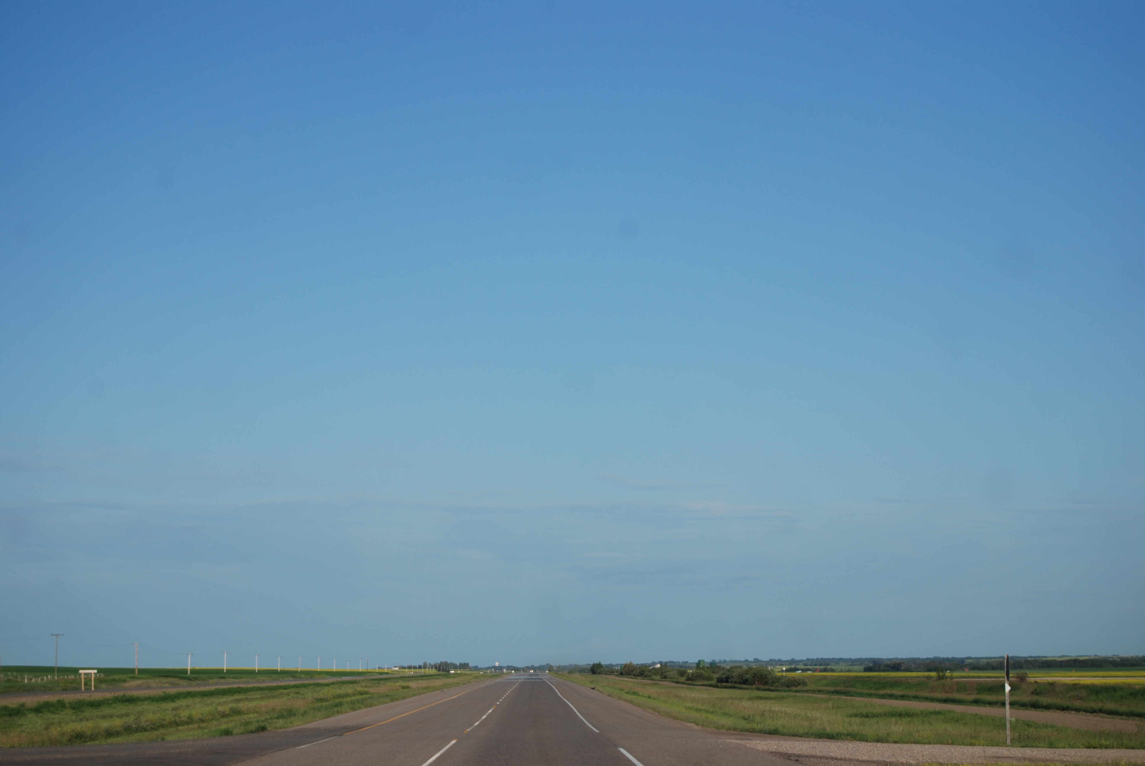
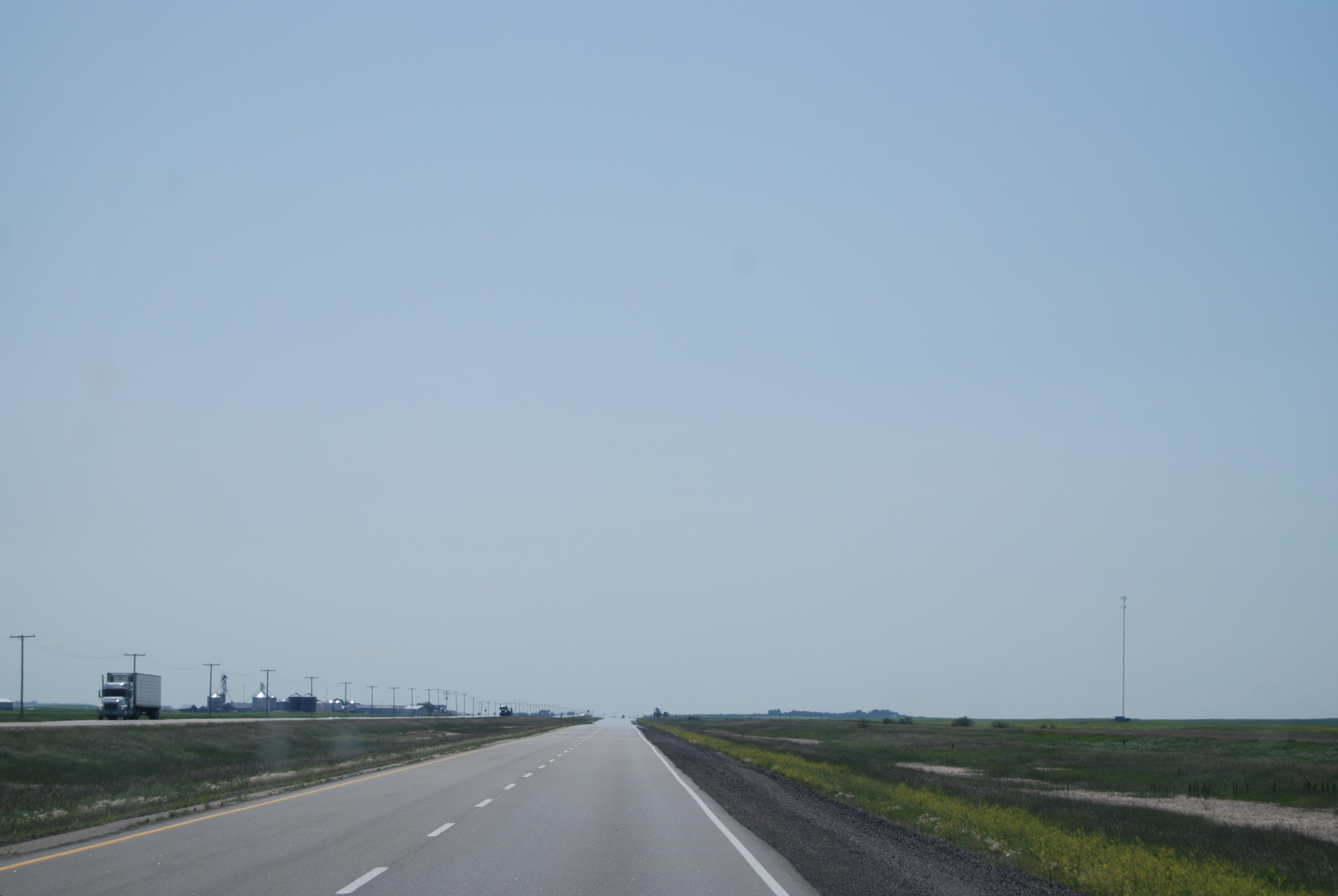
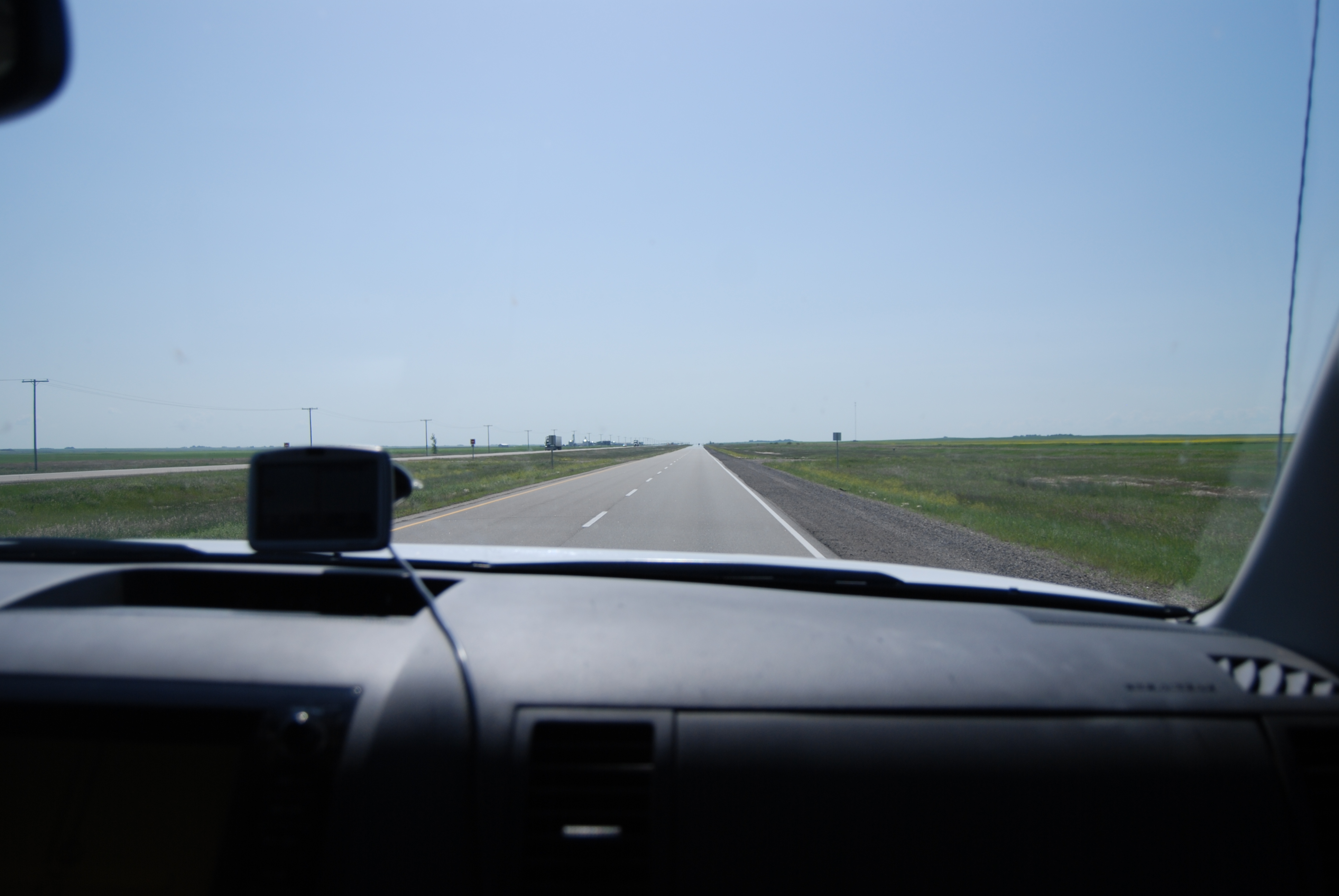
When you drive from sea to shining sea on the Trans-Canada Highway leaving from one coast or the other, and hit either central Alberta from the west or Manitoba from the east, you hit flat. You hit relentless, unchanging flat for many hundreds of miles. So much flatty flatness of flat that you fall into a sort of flatness-shocked daze.

It’s very, very flat.

I mean, the Big Sky is nice, and all, but…

My uncle used to tell about driving across the prairies, and he would say, “You just start to ask yourself, ‘Did no one think to plant a tree?’” The Trans-Canada flatness leads many travellers with whom I’ve spoken to assume that the prairie provinces as a whole are a barren wasteland of mercilessly tedious landscapes.

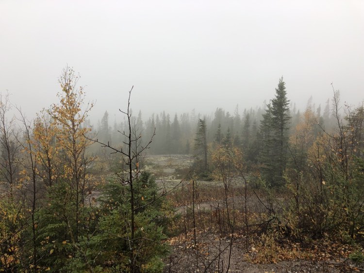
I submit as evidence some passenger-seat photos from previous X-Canada road trips with the Mister, during which the flatty flatness spanned approximately 12 hours of time on the road:

Alberta flat.
Saskatchewan flat. (Oh look, there’s a clump of trees in the distance!)
Manitoba flat. (When will it eeeeeend???)

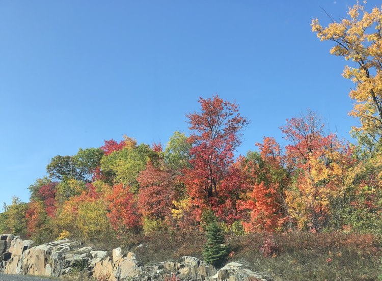
Thing is, if you venture a hundred km north or south of the Trans Canada, the prairie geography morphs into varied panoramas of stunningly beauty. Cypress Hills Provincial Park, Grasslands National Park, Riding Mountain National Park, Spruce Woods Provincial Park – none of them could be described as either flat or tedious.

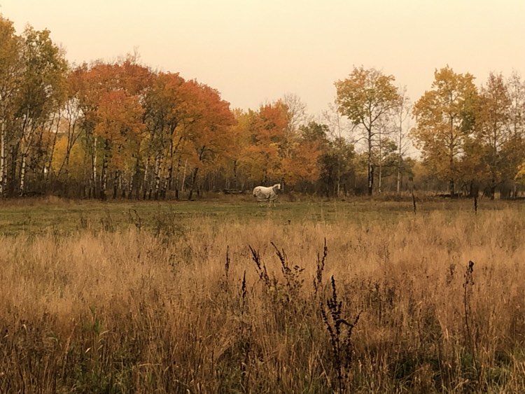
Another case in point would be the Souris River Bend Wildlife Management Area in southwestern Manitoba.

Just under a year ago, I stumbled across the Friends of Souris Bend Facebook group. Over the subsequent months, the very pretty photos that would pop up on their page got me all intrigued about this place I’d never heard of. I’m always keen to find at least one or two new places to explore when I’m on my road trips, so I added Souris Bend to my west-east itinerary as a potential camping option.

Camping at a Manitoba Wildlife Management Area – real estate that is not provincial parkland but rather designated crown land set aside “for the better management, conservation and enhancement of the wildlife resource of the province” – is free, but requires a permit, which can be applied for online (see Camping Notes below). I was originally going to head for the Middle Camp, but some intel from the Facebook page admin suggested that, given the rainy forecast and the possibility that the clay road to Middle Camp would become impassable, South Camp might be a better option.

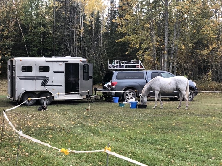
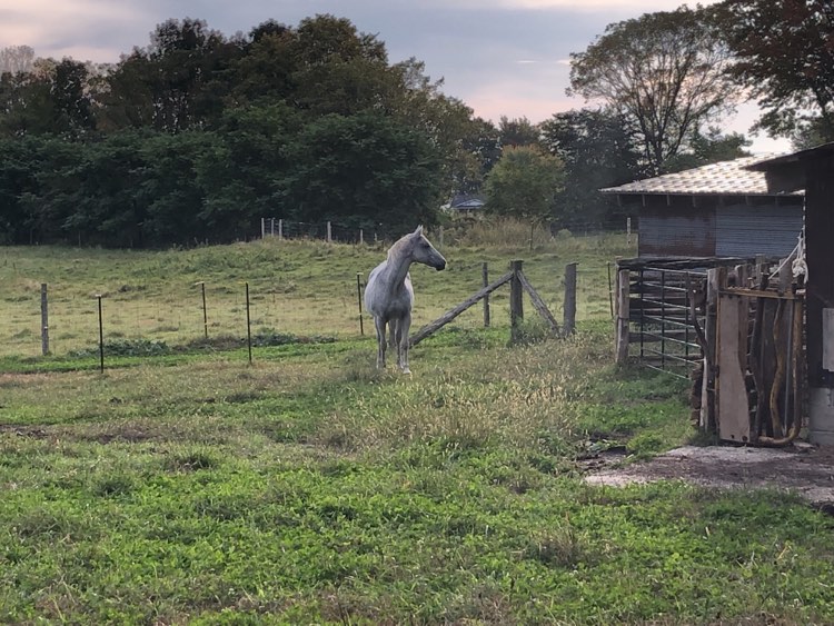
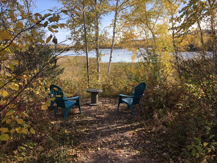
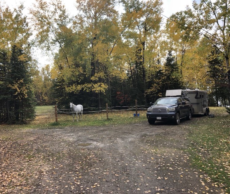
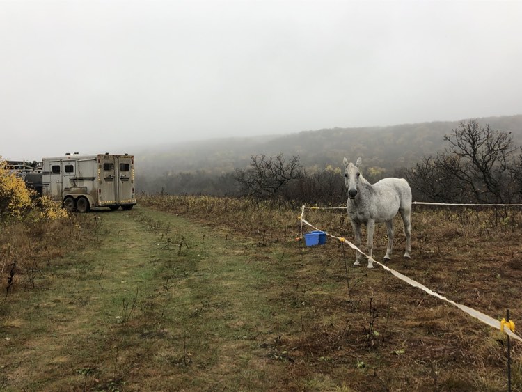
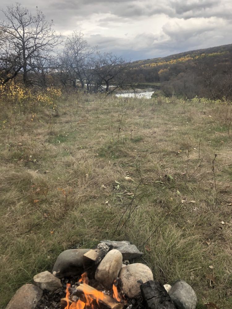
We pulled in to the empty camp – “camp” being a somewhat hyperbolic term for what consists of a map and an outhouse in a field of prairie grass – in the early afternoon. A silent drizzle enshrouded the place in misty white silence. A hundred yards or so distant from the sign, tucked around the back side of a clump of alders, we found a picture-perfect campsite: someone had built a stone fire pit on an escarpment that overlooked the Souris River.

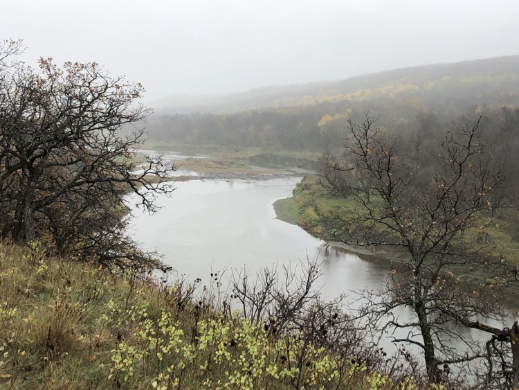
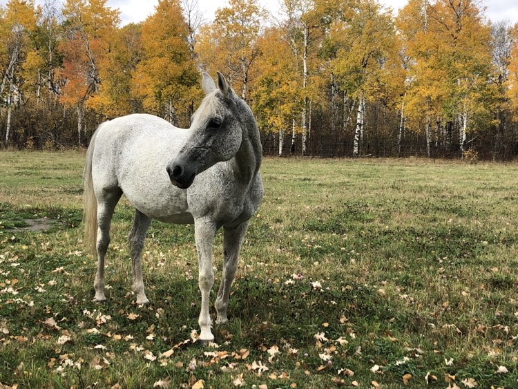
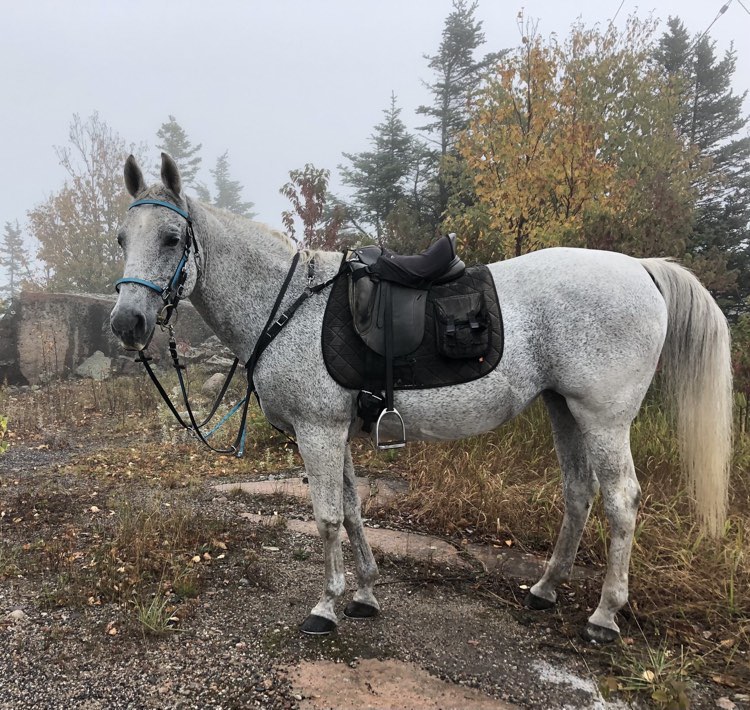
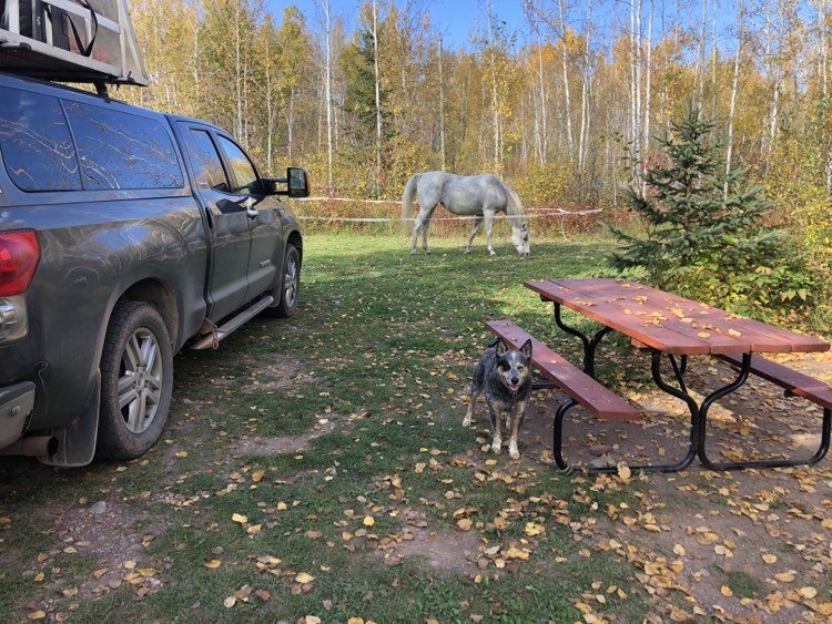
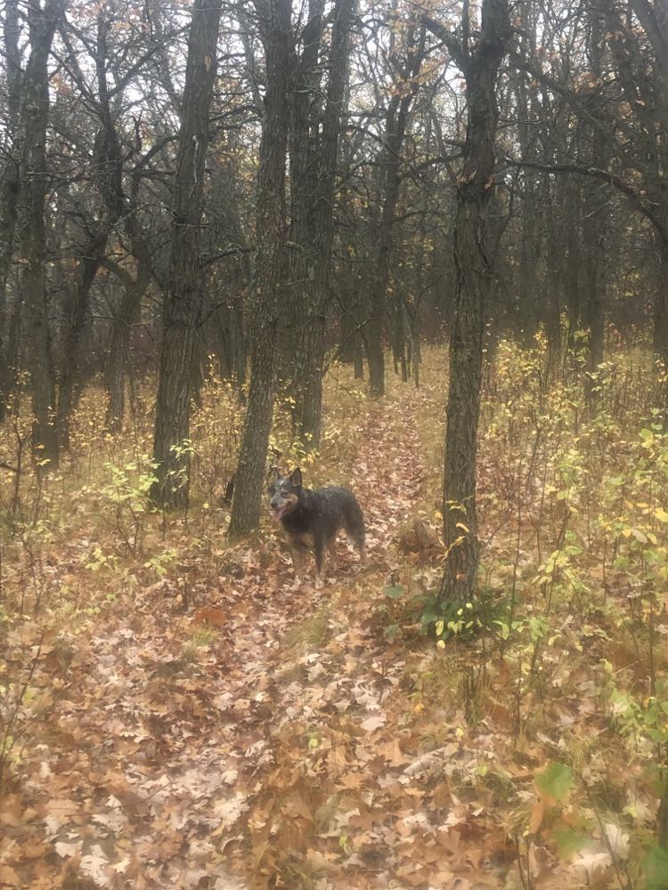
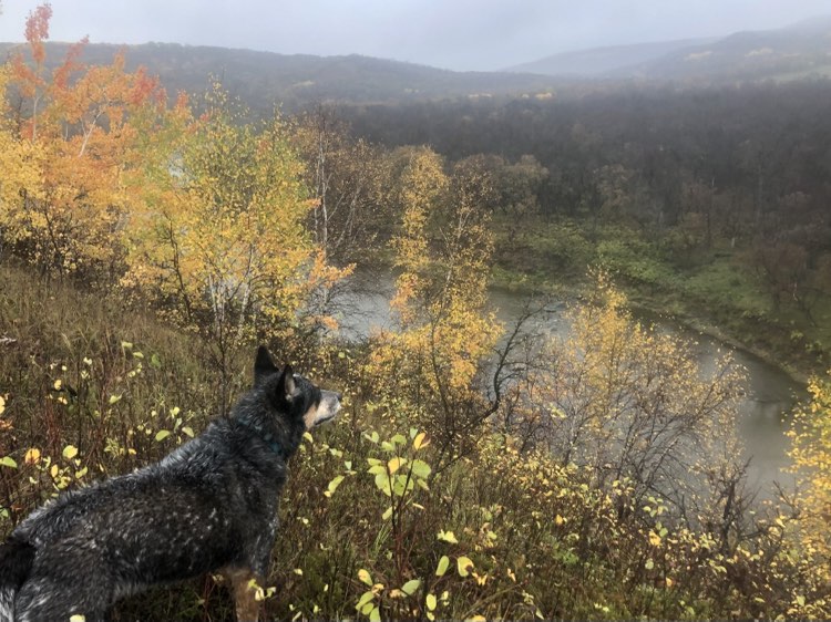
Normally, having had a short haul to camp and with the whole afternoon ahead of me, I would saddle up and head out for a short stretch-your-legs jaunt on the horse. But with the weather being uninspiring, and Spy being under-exercised, I decided – after spending a half hour or so cleaning the layer of caked-on clay off all the high-touch parts of my rig – to take the pooch for a spin instead. We trudged along under the dripping sky for an hour or so, scoring views of the river that were gorgeous even on a wet grey day.

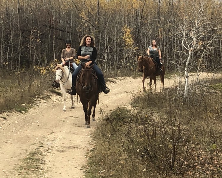
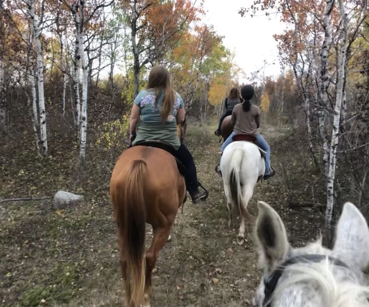
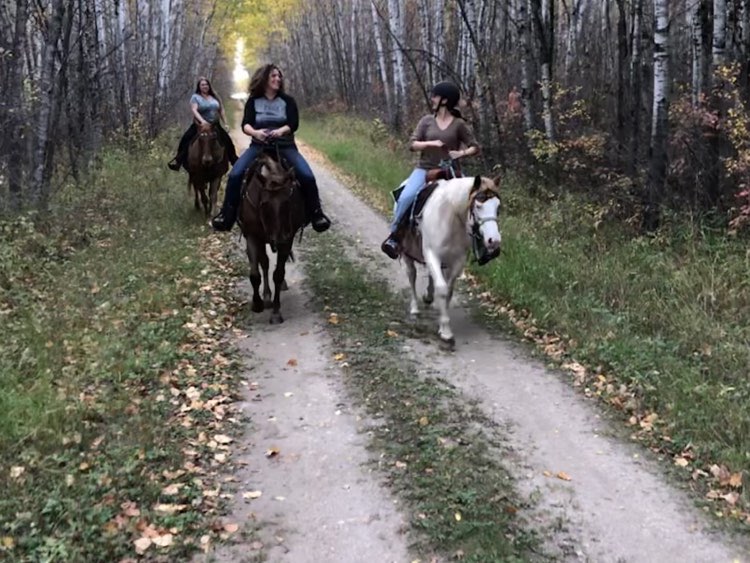
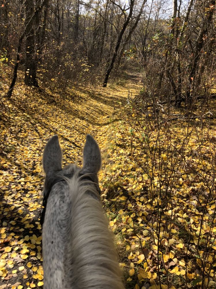
The next day dawned cool but fine. I was in no hurry to climb into the saddle before the sun warmed the air a bit, so by the time Pai and I hit the trail, it was close to 10 a.m. After struggling on the previous day’s dog walk to figure out why the river’s course wasn’t what it looked to be on the map, I’d figured out that the “You Are Here” pointer on the map was not anywhere near to where we were – it was indicating a spot about 400m northeast. That vital tidbit of information at hand, I had a good sense of the lay of the land. The trail marking was superlative, and I had no trouble navigating a route that looped us 20-some kilometres north, crossing and re-crossing the river at the indicated fords.

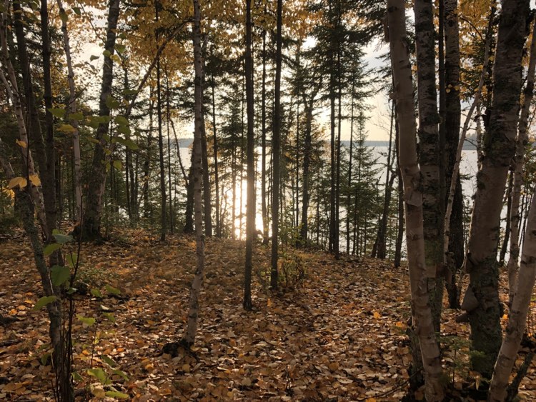
From the very moment we set foot on the trail, our Souris Bend ride was a delight. Our 4 ½ hour route wound through rolling hills, descended through mixed forest to the riverside, and climbed to expansive views over the river. Although much of the forest was already leafless, the aspens were still cloaked in gold, making for a gilded carpet on the paths where they’d dropped their foliage.

Green (easy) trail option at Hallelujah Hill
View over Souris River somewhere south of Middle Camp, west side.
View over Souris River from west side, on Blue (or maybe Purple) trail.

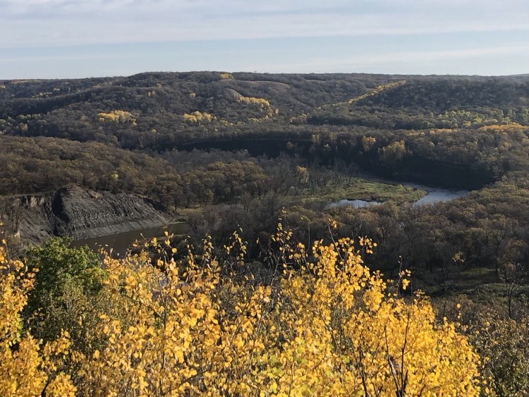
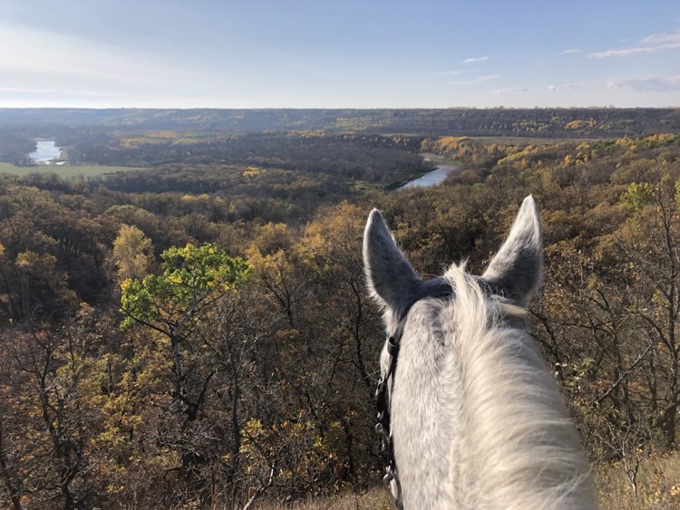
The northernmost point we reached on the ride was the sunny top of Amphitheatre Hill, which, on that 18C day, made for a near-summery lunch spot.

Lunch stop on Amphitheatre Hill
River crossing at Middle Camp

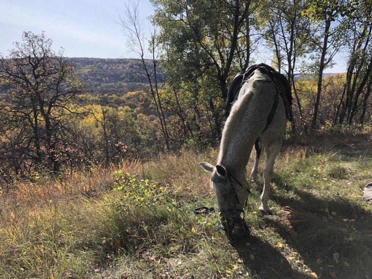
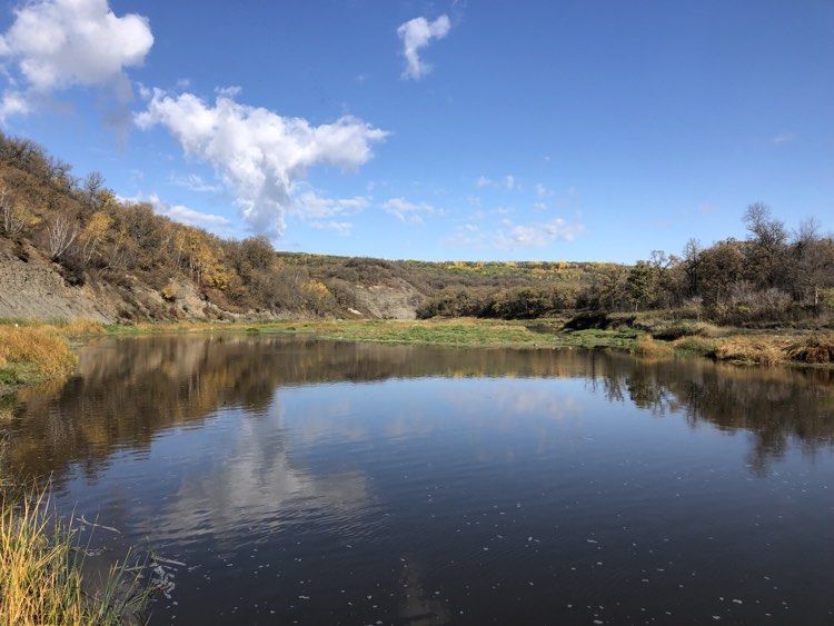
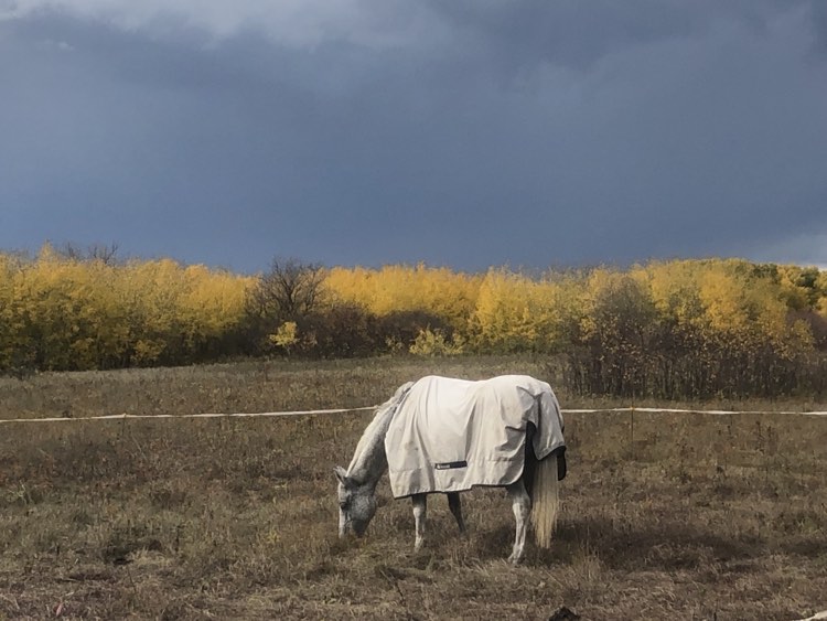
Very soon after arriving back at camp, having met no one else on the trail, the skies closed in once again – I’d just thrown Pai’s blanket over her back when the drizzle began anew. In the almost-dry spells between the half-hearted showers, I managed a bit of chill time at my campfire with its stunning view over the river, and even succeeded in cooking my dinner outside without getting drenched, but ultimately, the rain won. I packed it in early and retreated to my “living quarters” for most of the evening.

When I pulled up stakes the following morning, I was wishing the weather and timing had co-operated better for a longer stay: if Souris Bend were a movie, it would be a cult classic – a little-known gem that spawns ardent appreciation among its devotees. There are few such flawless trail systems in all of Canada – I’m looking forward to visiting again.

Camping Notes for Horsey Folk

No permit is required for day riding in the Souris River Bend WMA.

Had I not joined the Friends of Souris Bend Facebook group, I would have been utterly unaware of the requirement for a camping permit, since information regarding camping in WMAs is tricky to find on the government website or via Google search. I was also forewarned that the permit can take a month to process, and so I submitted my request in late August, specifying a vague camping date range (mid-to-late September). It took a few follow-up phone call a few weeks later while driving through The Lands of Crap Cell Service (Northern Ontario) before I finally received a verbal OK for my plan the day before I was driving out to Souris Bend – my actual emailed permit arrived several days after I’d been and gone. (I must say that the folks at the government office are very nice, so if you’re having troubles, don’t hesitate to call!)

Main line (Parks information): 1-800-214-6497 or 204-945-6784

An online application form for Wildlife Management Area Use can be found here (scroll down to WMAA-Wildlife Management Area Use Permit Application in the Wildlife section, and click on “Apply”). As their website currently stands, you must go to your cart after submitting the form in order to complete your application.

There are 3 campgrounds at Souris Bend: North, Middle, and South. Camping is free. All of the camps feature an outhouse and a map. There is no potable water and there are no pens, nor is there much opportunity to highline unless you set up your line between two rigs.

The reason Middle Camp was my original destination was that it offers loops departing both northward and southward, and I was originally hoping for good weather and two days’ riding. Middle Camp’s mile-and-a-half road in becomes impassible after heavy rain. There is no cell service at Middle Camp. I rode past it on my route, and it is a very large flat field adjacent to the river, with easy access to the water. The “You Are Here” pointer on the map is correct.

South Camp is adjacent to the road, and can be accessed in inclement weather. It is located high above the river (no easy access but you can climb down a very steep path on foot – not suitable for horses) and so you must bring horse water. There is sketchy cell service at South Camp. The “You Are Here” pointer on the map is incorrect.

My 20+ km ridden route. South Camp is at the bottom left starting point of the yellow highlighted route, approximately 400m from the pointer on the map.

I did not visit North Camp. It is, from what I was told, accessible in rainy weather, and has cell service. From the map it appears to be well away from the river.

The trails are mostly wide grassy or sandy tracks, with some offshoots that are winding single-track; all of the few trails that are very steep appear to have easy go-arounds. The footing is excellent and is suitable for barefoot horses. The river crossings are well-marked, including entry and exit points on each bank. Trail signage and mapping are near-perfect. Trail maintenance was outstanding.

Friendship and Horses: Richer, MB Oct 2-3, 2023

On these X-Canada trips, meeting like-minded horsewomen (and, sure, horsemen, but truth to tell, it’s almost always women) is one of the best parts of the journey. Despite the fact that, given the option, the company I choose to keep is generally my own, I nevertheless delight in talking to women who share a similar feeling for the horses they ride and train and care for – and, who, ultimately, share a similar feeling about how life ought to be lived. Anna Maria in Oliver, Pam in Cranbrook, Vanessa in Taber, Dawn in Pilot Butte – these are ladies I first met sans their menfolk, and whom, after whatever initial fortuitous meeting put them in my path, I make a point of seeing again and again and again.

Last fall, on my freezing-cold October trip west, I met buddies Kristen and Sandra when they turned up as the only other campers at the closed/not-closed/pretty-much-closed equestrian campground in Spruce Woods, Manitoba. Across the campfire, beer in hand, we talked long into the night about All Things Horse. Kristen mentioned that she was thinking of offering layovers at her farm just north of the Trans Canada, and, on this 2023 trip west, I messaged her about maybe stopping by her place for a night.  The timing just barely worked out – she and her man were on the verge of departing for team penning Nationals in Calgary – but it did work. And so it was that I rolled in to her farm on a sunny, 20C October afternoon.

You know someone is an exceptionally attentive host when they remember you saying, one year prior, that camping isn’t camping without a campfire, and they therefore make sure to have a fire ring set up where you’ll park your rig, as well as making sure a friend delivers two bundles of firewood. (Who does that? Kristen does that.)

Pai in her queendom.

The timing of my stay not only worked with Kristen’s imminent departure for Calgary, but also coincided with the one day she had been able to make herself available to go trail riding with her friends. Danielle (She Who Bears Firewood) and Emily arrived shortly after I got Pai settled in her enormous pasture, and soon enough we four were heading off onto the trails that are adjacent to Kristen’s farm.

The trails go on and on and on. Our late afternoon ride had us out for just a couple of hours until the sun was setting, but the options for longer loops looked limitless.

Immediately after I unsaddled her, Pai, who had been 100% her usual Queen of the World self on the trails, began to show signs of mild colic. I’d had two horses meet their maker via catastrophic colics, and so I tend to be hyper-vigilant about the possibility of seemingly innocuous signs going very, very bad. I whipped out my stethoscope and morphed into doctor mode. Pai’s physical exam showed little untoward other than very quiet gut sounds, so I elected to just watch her and see how things played out. She lay in the grass by my campfire as Kristen and Danielle and I chatted, I with only half an ear on the conversation. Forty-five minutes later, Pai pulled herself up, and started chowing down on the lawn grass with enthusiasm. Her previously rejected dinner was now delicious, and all was well in horseland.

Phew. The binders of intel I’ve been gathering since 2012, data accrued from planning previous trips and scrawling down details gleaned from the road, do include options for emergency vet care (e.g. who can I call who might do colic surgery in BF Nowhere SK? Or in the equestrian wastelands of Northern Ontario?), but when it comes down to it, I would clearly way prefer to flick through those pages looking for best gas prices, great lunch stops, or alternative accommodation than to be figuring out who I can call at midnight who might be (a) willing and (b) able to keep my horse alive in a medical crisis.

So: phew.

A campfire is a hard place to pull away from, and so Kristen and I spent another couple of hours jawing by its light. I think it was 10 o’clock before I threw a can of baked beans into a pot and cooked (using the term “cooked” loosely) myself something to eat before hitting the hay.

Morning

Plans were made over breakfast to meet up again next fall for a longer stay, with some riding in the nearby Sandilands Provincial Forest. Then, under darkening stormy skies, I loaded up my pony, setting out for a couple of nights camping at Souris Bend Wildlife Management Area.

Hanging Offences in Northern Ontario: St-Antonin-Dryden Sept 22-Oct 1, 2023

If you’re not yet convinced that humanity is a pestilence upon this planet, I challenge you to go take a walk or a ride on any trail that is accessible by motorized vehicle, and be dumbfounded by how far into beauty people are willing to drive in order to defile nature with their trash.

My short morning ride at Neys, Ontario, was one such reminder of the depravity of the human race.

On my various X-Canada travels, my main goal when it comes to Northern Ontario has simply been to plough through it. I love the drive itself, with its miniature lakes and pink and grey rocks and stalwart trees, but my priorities when it comes to hanging about in a place have always lain west (riding in MB/SK/AB/BC) or east (visiting family and friends and my Dad). Aside from my many rides on Tom and Marg Loghrin’s trails in Thunder Bay, I’ve not lingered at many of my overnights for horseback exploration of local trails. On this trip back west, I decided to split up some travel days and spend a morning riding at Neys, which is in the middle of nowhere on the shore of Lake Superior. The campground owner had more than once mentioned that there were trails adjacent to her property, one of which led up to a cell tower on a high hill, visible from camp. I decided to budget some time to check it out.

Tons of room for a big e-corral at Neys Adventures

The trail to the cell tower is a short 4 km one way, first on a sandy gravel road and then on a rough two-track. For the first two kilometers, there wasn’t a stretch of more than five feet that wasn’t littered with garbage: plastic bags of all sorts large and small, coffee cups and their lids, plastic tubs, Styrofoam containers, beer cans and pop cans and iced tea cans, tires, tampon applicators – you name it, it was in the woods.

Where do these dickheads folks drive in from with their shit? Who raised these filthy crusts of cock cheese people?

It’s a mystery, but no matter where you go, these sonsabitches litterbugs go there too. (“Hey honey, you know what would be real nice to do today? Let’s go for a drive up along the lake. Grab that bag of trash, baby, and we’ll find a pretty patch of moss and ferns to dump it out on.”)

My grumpy badass Dad and I have a game where we decide how we would run the world if we had unbridled power. He would institute capital punishment for people who mistreat dogs or horses. I would hang people who dump their shit in the woods. I mean, really – think about it: the world would be better for having those rules. Go ahead and vote us in as your Omnipotent Ruler tag-team. You won’t regret it.

Once out of Off Grid in New Brunswick, I followed much the same route, with much the same stops, as I’d traveled in 2022. From Royabie in St Antonin (mercifully skunkless!) we carried on to my Dad’s, where I visited for a couple of days before moving on.

Royabie residents
Skunkless sunset walk at Royabie with Spy the Dog.
Two dozen fishcakes – check!

Our next stop was in Orillia, where I once again parked Pai at Moon Point Acres and visited with my friends Mark and Margaret.

Pai at home at Moon Point Acres
Sunrise over Lake Couchiching

And from thence we worked our way north to Cedar Rails Ranch in Wharncliffe, and onward to Neys.

Living on Vancouver Island, one of the very few things I miss about Ontario, my childhood and young adulthood home, is the jaw-droppingly spectacular show put on by the autumn leaves. The tragic effort at red or bronze put on when BC’s dogwoods and occasional understory shrub have a crack at autumn are no match for the wanton palette of scarlet and crimson and cherry and fluorescent orange and flaming [orange] that is flaunted by the maples of the East.

Last fall, on my ill-advisedly late-in-the-fall trip home, I hit the peak of fall colour in New Brunswick and Quebec and Eastern Ontario, but by that time of year, the trees in Northern Ontario had largely dropped their foliage, and the only over-stayers at the party north of Sault Ste Marie were tamarack and aspen still hanging on to their yellowing leaves. This year, traveling the same road three weeks earlier in the season, I caught a lot more colour in the north of the province.

On the drive to Cedar Rail Ranch

As I was packing up at Cedar Rail, it occurred to me that I had likely made a suboptimal decision about where to spend my upcoming trail riding hours. Kathy, the camp owner, had mentioned that she had a 2-hour out-and-back ride to one of her cabins, and, with a sunshine-y forecast, and the trees at their absolute glorious peak, it would have made for a fabulous day-ride in Northern Ontario. Instead, my Northern Ontario ride would be taking place the following day in what was unquestionably going to be crap weather, and would be far enough north that my beloved reds would be in short supply.

And indeed, on my riding morning, the weather was grey and drizzly. I’d been hoping for expansive views of Lake Superior from the cell tower hill, but alas, in that mist, no view was to be had.

What should have been a view back down to camp.

Pai, whose soles are normally like iron, was – thanks to PEI’s rainy, hoof-softening summer – footsore on the stony terrain. I got off and led her for a good kilometer or so over the rockiest bits. We rode past the same garbage on our way back to camp, packed up, and hit the road west.

From Neys, it was a short couple of hours to Dorion, where we were set to camp at a new-to-us “people campground”: Latibule RV Resort, a place I’d found on HipCamp, which is the camping version of AirBnB. The folks there had set aside a roomy gravelled site for us at the far end of the campground, but I eyed up the adjacent site and decided it was far more suitable – grass for the pony, and a picnic table for me. A quick word with the powers that be and we were in like Flynn. The campground was largely populated by seasonal campers, and, over the course of the evening, Pai had a slew of visitors.

Her Majesty had a steady stream of visitors over the course of the evening.
One of many viewpoints over the lake.
Our Latibule campsite

We carried on from Dorion to one of our tried-and-true camping spots at Merkel’s Camp in Wabigoon. This hunting/fishing camp is owned by the cousin of my Vancouver Island barn owner, and when we roll in, we are treated like family. What with crossing a time zone boundary line, we arrived early in the afternoon, giving us lots of time for camp set-up, dog stick-throwing in the lake, and a leisurely cook-up of the shaggy mane mushrooms I found on site.

Campsite at Merkel’s Camp
Evening view from my campsite

As I was pulling up stakes at Merkel’s Camp, where the forecast for the next two days was 26C and sunny, I once again questioned my travel decisions: I was headed for Manitoba, where the forecast at my upcoming 2-to-3-day camping site included rain and severe thunderstorms. The idea of simply hanging out at the lake for a couple of days was very, very tempting, but I’d made time-sensitive plans to stay with a friend in MB that night, and so, for better or for worse, we made for the prairies.

Camp Notes for Horsey Folk:

I’ve described Cedar Rail Ranch in this 2018 post .

But I’ve never said much about my “people” campgrounds in past posts. So here’s the dirt:

Merkel’s Camp (Wabigoon): This is a hunting/fishing camp on a gorgeous lake just east of Dryden. There are rental cabins, and seasonal campers with trailers, and a few sites available for overnighters. “My” spot is a place on the drive that is adjacent to a bit of grass where I can set up an e-corral. In the off season, I have a more choice spot that gives Pai more grass and gives me a view of the lake. The camp has flush toilets and a hot shower.

Neys Adventures: Neys is a private campground directly across the highway from the provincial park. They have scaled back considerably since COVID hit in 2020, and in the past two years that I’ve stayed, the shower hut has not been operational. They throw me out the back (about 400m from the highway) in the group camping area, which has ample room to set up a very roomy e-corral. There’s an outhouse back there, but no water.

Latibule Resort and Campground: At the time I stayed, there were probably three or four sites that would suit setting up an e-corral or using a Hi-Tie. Latibule is under expansion, so I expect there will be even more suitable sites in the future. From chatting to a seasonal resident, it sounds like there are trails across the road if you wanted to take a quick jaunt. Water was just across the lane from my site. There was an outhouse very nearby, and flush toilets and a shower a short stroll down the lane. It is a very scenic spot on a wee lake.