I Left a Year Ago, I Left an Hour Ago – Fairmont Hot Springs, Rock Creek, Oliver, and Home – July 22-25

It’s a measure of my level of chilled-out-ness after six weeks of travel that when I left Ya Ha Tinda on Wednesday morning, I still did not know where I would be spending the night – hitting the road with that kind of uncertainty is not at all consistent with my control-freak personality. Not knowing where I’d be laying my head (and my horse’s head) for the night meant I also did not know which route I’d be taking home – through Kicking Horse and Rogers Pass to Golden and Salmon Arm, or through Kootenay Pass to Invermere and Oliver? I was hoping to take the latter route, since I’d heard good things about the riding in Rock Creek, near Oliver.

After driving southeast, chasing that morning’s furious thunderstorm with its attendant hail and rain, we hit Cochrane, and I paused to do some web searching and phoning around. One of the last places I called, on the suggestion of an outfitter I thought was local but who was in Alberta when I called his cell because he’d pulled up stakes and moved, was the trail riding stable at Fairmont Hot Springs. I got ahold of Brent, who was completely accommodating. “Oh sure,” he said. “There’s a paddock off to the side you can use.” No problem.

So the southern route it was.

fairmont paddock

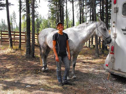
Pai’s paddock at the trail riding stable

The girls at the stable told me I could just park my rig at the stable and camp there – and a very scenic campsite indeed it would have been – but I was hankering for a hot shower. I opted for the campground at the resort, and was assigned a site that was within walking distance of the stable.

Unlike a lot of campground showers, which feature little buttons that you push and which let out a sad trickle of lukewarm water for 30 seconds until you push the button again, the showers at Fairmont have real faucets with unlimited water. The controls start at “hot” (read, “scalding”), progress to “warm” (read, “very, very hot”), and finally dial over to “cool” (read, “normal temperature for people who like hot showers”). I may be making this up, but I’m going to say that being a hot springs sorta place, they actually need to add cold water to their hot water, rather than vice versa. Given that it had been a month since I’d had a real shower (i.e. not in a camper and not out of a bag), I went crazy. I must have spent 20-30 minutes in that shower (it was early. No one else was up).

I’d have liked to have stayed and ridden some of the trails at Fairmont, because the area looked gorgeous and I bet the trails were awesome, but I wanted to spend my few remaining days exploring the Southern Interior, country I had not yet experienced. The next morning, off we headed to Rock Creek, which is an hour or so west of Oliver.

My camping destination for the next night or two was the equestrian campground adjacent to the Rock Creek fairgrounds. Unfortunately, the “people” campground was closed for the weekend for a private function, which meant that the equestrian campground was also closed. Jodi, the fairgrounds contact person, said it would be OK to take a stall at the grounds, and camp there, so that’s what I opted to do. I set Pai up in a comfy corner stall, and parked directly in front of her, which allowed me to make use of a nearby power source to keep my sketchily-wired fridge charged (I’d given up on storing food in the fridge long ago, and was now using it solely to keep beverages cool), and recharge my laptop (my camper inverter was likewise on the fritz).

I took Pai out for a short, 45-minute “stretch your legs” ride in the evening once the air cooled down a bit, and then cooked myself a dinner of cedar-planked salmon, and then spent the tail of the evening quaffing wine on the porch with the delightful Mel, who is the on-site fairgrounds camp operator. Mel is a former competitive vaulter from Germany, and now trains horses and teaches vaulting to local kids. We chatted and sipped wine into the evening, while her kids camped out in a tent in her back yard.

Rock evening ride

Evening ride on the Kettle River trails.

Since there were no maps in sight at the trailhead, Mel pulled out a big poster from a previous endurance ride that had been held there a few years prior, and I took six pictures of it with my phone as a fun, “guess which trail connects to which” puzzle. (And then Spy turned the map into a real puzzle when I had my back turned, and I found him in a pile of poster confetti. I spent 20 minutes before my ride duct taping the back of the pieces back into some semblance of a map). The pics did help me orient myself for my ride the next day, but since I have mad skillz when it comes to getting lost, I got lost.

The Kettle River Trails depart from the fairgrounds and spread north in loops of various distances. I managed to get off track somewhere around 10 km onto the trail, when I decided that I probably was on the Guard Trail, but, clearly, wasn’t. I’ve got a stubborn determination to ride loops rather than out-and-backs, so, even when I know I can get back to where I came from by retracing my path, I tend to choose to press onward, hoping to find that elusive loop home. As I texted Mr Andrews, “I know where I came from. I just don’t know where I’m going.”

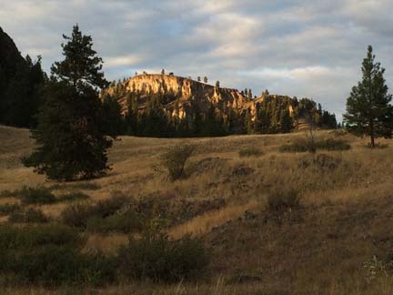
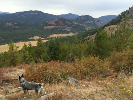
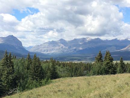
The Kettle River runs through Rock Creek, and it is surrounded by high terrain that varies vastly in its vegetation, from sage-clad dry grass hills with a few cactus and the odd rattlesnake, to open forest of red-trunked Ponderosa pine on grass, to more dense forest of fir and brushy undergrowth.

Rock Spy admiring view

Spy admiring the view. Or wondering whether we’ll ever get back to camp. One or the other.

Rock Spy ponderosa pines

Riding through the Ponderosa pines.

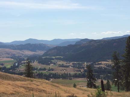
Rock view of valley

View back over towards the fairgrounds.

My ride ended up taking longer than I’d planned, and I came home via a quiet road rather than on the trail I thought I’d end up on, but it all worked out OK. I figure we rode somewhere between 20 and 30 km. I spoke to local gal Jenny, who knows the trails well, and she reckoned I’d gotten a pretty good taste of what the area offers.

Despite having had a pretty decent ride on some lovely trails, at 4 pm, after untacking and cleaning up my horse and getting her fed, I decided that my make-do fairgrounds “camp” parked within earshot of Hwy 3 just wasn’t doing it for me as a way to wind up my trip. After flipping through my notes for possible alternatives, and then and firmly deciding it was more sensible to just stay put at the fairgrounds, I picked up the phone and called Hideaway Horse Camp in Oliver. The camp owner was charming and welcoming on the phone, and said I’d have the camp to myself. Sold!

Oliver wild horses sign

The only other place I’ve seen one of these wildlife signs was near 108 Mile in the Cariboo.

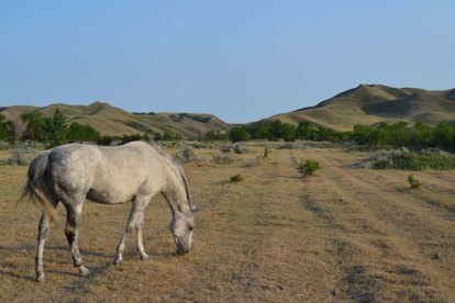
They have wild horses around Oliver, too, and I saw a herd of healthy-looking mares and foals on my way in to Hideaway.

Hideaway wild horses reduced

Hideaway Horse Camp ended up being just a perfect way to end my travels. The camp belongs to Anna-Maria and Larry Robinson, and its four campsites and roomy corrals are set on a treed hillside adjacent to Crown Land. Anna-Maria is a great host with a knack for making guests comfortable. We gabbed for a couple of hours after dinner on Friday night, and, on Saturday morning, as the night’s drizzle started to clear, she sent me off on the trails with a couple of (delicious) homemade banana-peanut butter granola bars.

Anna-Maria has put a lot of effort into mapping and marking the trails well, but I still managed to lose the plot on my Saturday morning ride. I’m really, really good at leaving the tour. I didn’t snap any pics on my ride along wide, grassy and sandy trails, since the day was misty and the views were barely discernable behind cloud. I know they’re there, though! Someday, I’d like to come back and see them for real.

Rock SHA and Pai - reduced

Back in camp after our very last ride of the journey.       Photo: Anna-Maria Robinson.

We left Hideaway at noon, and hit Horseshoe Bay in time to catch an evening ferry back to the Island.

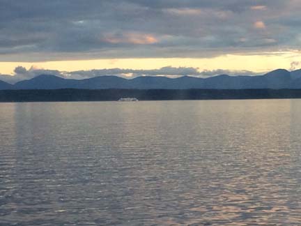
Ferry home

Approaching Vancouver Island.

As I drove into the barn yard, where Mr Wayde Andrews was waiting for me, it seemed like I’d set out on my trip a year ago. And yet it seemed like I’d only left an hour ago.

It took six hours, the next day, to clean out my truck and trailer. In six hours, over six weeks on the road were erased, and it looked as though I’d never gone anywhere at all.

Camp and trail notes for horsey folk:

1. Fairmont Hot Springs Resort

Fairmont has hiking trails and trails that are used by the trail riding crew. I don’t know how often they are asked to board horses, but Brent was very accommodating, and it looks like it would be a fine place to camp and ride for a few days. Stabling in a roomy paddock was $15 (unofficial price); camping fees range from $30 for un-powered to $65 for deluxe powered. The stable is less than 1 km from the campground, an easy walk.

As an aside, the Dry Gulch Provincial Park also agreed to house me and my horse for the night. They are located right alongside the highway, so it would make me a little leery to Hi Tie or use an e-corral there, but there it is as an option. As I drove by, I noted that there’s a big stable next door – a person could probably check out their receptiveness to overnight board, and then camp at Dry Gulch.

2. Rock Creek/Kettle River Trails

The Rock Creek Fairgrounds has a sign denoting the “wilderness” equestrian campsite. A more accurate term would probably be “wilderness-style”, since the campground is alongside a roadway and Hwy 3 roars by right across the river and doesn’t really hit the specs for “wildnerness”. It is, however, a minimal-facility campsite, which makes it kind of wilderness-y, with trees for high-lining on its nice, large, very level grounds; pit toilets; and water (somewhere – I didn’t see it, but it’s there somewhere). The “people” campsite across the road has showers and laundry. Camping is $12. You can also rent a stall at the fairgrounds proper, a few hundred metres down the road, for $20. There are no toilet facilities at the fairgrounds, but there is water.

There is no map at the trailhead, and no paper maps available when I was there, but after talking to Jenny, I think the fairgrounds folks will be supplying Mel with a stack of maps to hand out to riders, which will be awesome.

The trails have some sustained climbs, and some level riding once you reach the top. There are some lakes back there (I was headed for them, until I lost the plot). The footing, mostly along wide lane-like trails, is lovely. There are views here and there of the surrounding mountains and Kettle River.

3. Hideaway Horse Camp

Hideaway has four campsites with double-sized corrals in a gorgeous setting among the trees. There’s a cooking hut/shelter, an swank cowboy shower with stone flooring, and the World’s Most Uptown Outhouse. Seriously. You could just hang out in that outhouse.

Cost is $5 per horse and $10 per person.

Trails are well-mapped and well-marked. I only rode for a couple of hours, but you could spend a few days riding trails there. The footing is fantastic, and trails vary from wide grassy lanes to single track through the trees (and if, like me, you get lost and follow wild horse trails instead of the real trails, you do a lot of single track through the trees!). I didn’t make it to the little lake/reservoir, and I didn’t get to see what look like would be awesome views over the valley – I’ll have to go back sometime!

Hideaway Pai fired up

Corral at Hideaway

2015: Trail Riding Perfection – Ya Ha Tinda – July 14-22

The Ya Ha Tinda Ranch was one of my very few “must go” places on this trip. I intended to split about a week between Ya Ha Tinda and Hummingbird, or one of the several other equestrian campsites off the nearby Forestry Trunk Road.

Eight days later, I was still at Ya Ha Tinda.

Ya Ha Tinda means “Prairie on the Mountain”, or at least, so I was told by Ruth, the temporary camp host at the Bighorn campsite there. Ruth was replacing Tom, an eighty-year-old fella who generally looks after the campsites at Bighorn and Eagle Creek for Friends of the Eastern Slopes, but who had gone home for four or six weeks to hay. Ruth’s sister Jean and her brother-in-law Rick manage the Ya Ha Tinda Ranch, a 10,000 acre property bordering Banff National Park and owned by Parks Canada, which is where the Parks patrol horses are wintered, and trained, and where Parks equestrian staff do their courses and their continuing education on horsemanship.

Ruth gave me the lowdown on the ranch history and area ecology, and also delivered to me news that just about brought tears of joy to my eyes: dogs are allowed on the trails. I’d been keeping Spy tethered/kenneled/leashed, as per the “dogs must be on leash” signs posted everywhere, resulting in my puppy turning into a crazy thing. I’d taken him out for a 35-minute run that morning, and then for an hour’s walk (flouting what I thought were the rules and letting him off leash on a gorgeous little trail along Bighorn Creek to the falls) – neither of which came anything close to the amount of exercise it takes to make him something resembling civilized.

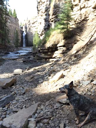
ya ha spy at bighorn falls

Spy at Bighorn falls.

Ruth, who’d come by my campsite on my second day with her Aussie, Molly, cheerfully trotting beside her off-leash, poo-pooed the idea of dogs needing to be on leash. “That’s only in the campsite,” she said. “And really, all anyone cares about is that your dog is under control.”

So suddenly, life became better.

This conversation took place as we were sitting at her picnic table, just outside the amazingly well-appointed tarp-fest that is Tom’s summer abode. He has solar panels, a generator, a fridge, a freezer, an ice-maker, a sink, a well-stocked bar, and a woodstove. Pretty much around the time Ruth told me the meaning of Ya Ha Tinda, we heard a sound like a chainsaw starting up, and then realized it was coming from inside Tom’s tent. When we rushed inside, the woodstove was shooting flames out the damper a foot long, and the tent was full of smoke.

Now she’s scared to go to sleep at night.

Anyway, Ya Ha Tinda is “Prairie on the Mountain” because, at an elevation of 5000 feet, and surrounded by mountains, it is an anomaly of a place, growing native prairie grass in a wide open valley with mountains on all sides. Elk over-winter here. My camp neighbour, Dan, told me there’s a photo from when the old Mountain Aire resort used to be located here, with 3000 elk on the hillside. I’d seen a small herd of elk earlier that day, out on my run with Spy.

There are wild horses too, but I never saw them.

I arrived at Ya Ha Tinda mid-afternoon on Tuesday, after spending a leisurely morning in Sundre. I’d managed to get my ass in gear out of Irvine’s by 8:30, and that got me to Sundre at 9:30, ample time to (1) get gas and ice; (2) go to the visitor’s centre and gather intel about getting to Ya Ha Tinda and other rec sites in the area; (3) call my Dad, with whom I hadn’t spoken in six weeks, and break to him the news that I’d been camping with my horse in remote wilderness areas for the past month (he who, once I finished the very safe, Trans-Canada highway oriented, X-Canada trip in 2012, breathed a sigh of relief and said to me, “Don’t EVER do that again.”); (4) fix my No Clean Underwear Problem by hanging out at the local laundromat, which, with its good internet service, also allowed me to do some e-mailing while I waited for my clothes; (5) pick up dog food, an Alberta fishing license, groceries, booze*, and a tarp (hoping to rig something to remedy the awning fail – did I mention it blew all to shit in Cypress Hills?).

*Alberta is not the wasteland of good beer that is Saskatchewan. Sundre’s tiny little cold beer and wine store had ample beer to please me. I stocked up, bigtime.

It took me more or less fifty tries to get my truck and trailer parked exactly just so in the camp site I had chosen. My neighbour, Dan, at one point asked if I needed help. I don’t think he realized that the issue wasn’t a failure of reversing skillz, it was an issue of obsessive perfectionism. I do this a lot, at campsites. I am sure onlookers think I am koo-koo bananas. Or can’t back up. One or the other.

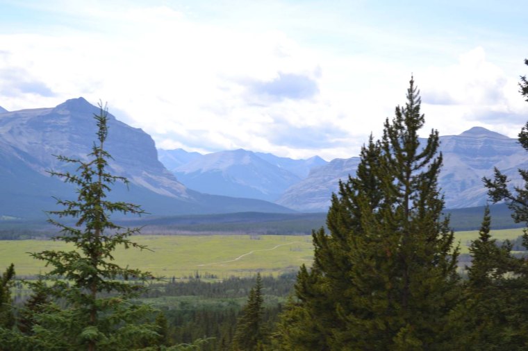
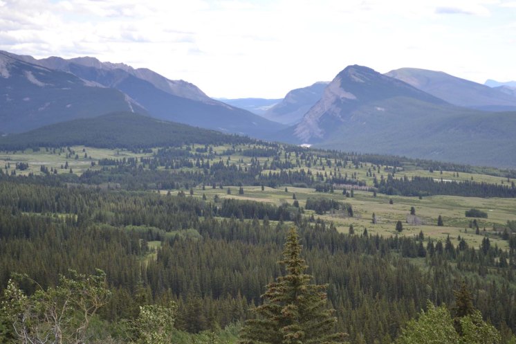
The wide valley in which the Ya Ha Tinda is situated offers amazing views in every direction.

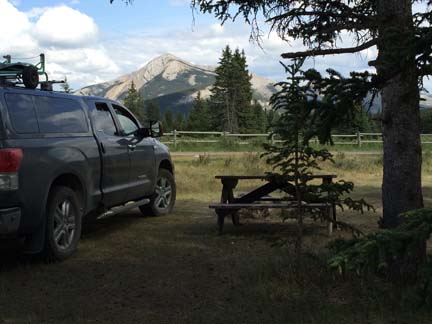
ya ha camp

The Cooking-Dinner-View.

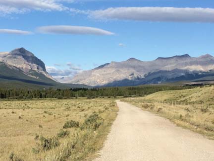
ya ha run

The Morning-Run-View.

This camp was the first time I used the Hi Tie, the gadget that was late getting to Nanaimo, and which Mr Andrews shipped to Vernon for me. Horses tend to prefer high lines to being tied to a trailer or standing in a tie stall, and Pai, who’d had a few short practice sessions with the Hi Tie at other campsites, was pleased with the arrangement. She had as much room to move around as she would have in a roomy stall, and she could lie down at night.

ya ha hie tie

Comfy on the Hi Tie.

Our first ride was a short 2-hour evening ride to Eagle Lake, which is a trail Ann had recommended. It was a pretty little ride to a pretty little lake.

The next day, I had the goal of reaching The Slides, another trail recommended by Ann, but, given that I had no map and only vague directions and a GPS that had run out of juice (and which, admittedly, I don’t really know how to effectively use, anyway), I ended up somewhere most definitely Not The Slides. We climbed a hill so steep that at one point, Pai asked to stop, and her legs were trembling. I got off and led her, and by the time we topped the rise, my legs were screaming. Luckily, when we were stopped for a break, two riders came by, and told me roughly where I was headed: the trail to Chinaman’s Cap (with the awesome news: “The steepest part is ahead of you.”) Workout though it was, the views over the valley from the highest point we reached (we quit before summiting the Cap) were stunning.

ya ha trail to cap

We started out at that river waaaaay down there. In the bottom right of the pic is part of the trail up.

ya ha warden from cap

Warden Rock

ya ha east from cap

Looking east from the trail to Chinaman’s Cap

My neighbour Dan is one of those folks I seem to be blessed with finding. He’s not a horseman, but he’s been coming here with his buddies for years, to hike. He comes in winter. When he said he came in winter, I assumed he meant to X-country ski, but no, he meant to hike. That’s how little snow there is here, despite the altitude and the latitude. He had to go into town to fix a flat, and so packed out my garbage and brought me water (I’d not realized that Ya Ha Tinda has no “people” water, and I was going to be tight). He also sent Ruth my way, to give me the lay of the land. And he gave me directions to Eagle Lake. When he left camp on Friday, he stashed some firewood in and under my truck, and left me yet more water.

On Thursday, Spy and Pai and I headed out in a freezing cold rain (it was 6 degrees C outside), off to find The Slides. My mare was in a good mood, and trucked along at a good clip with little input from me, which is a good thing, since I was busy trying to warm up my hands and wasn’t much engaged with steering. The rain cleared up after about forty-five minutes, and we got a bit of sun amid the clouds for the rest of the ride, as we crossed first a wildflower-filled meadow, and then wound our way through the trees, crossing the creek four times on the way.

ya ha trail to slides

Burnt-out forest on the trail to The Slides.

We did reach The Slides, which are a series of natural water slides on Scalp Creek, that skim the surface of smooth rocks and tumble into pools. It would have been an awesome lunch stop on a hot day – on a day like that, a bathing suit would be a must. We wound our way back along higher ground, and got home just before thunder and hail hit.

ya ha larkspur

Larkspur in the meadow.

As I’ve said before, being a woman traveling on your own with a horse always seems to grab people’s attention. I’m not sure whether people feel like they need to take me under their wing, or whether they are just intrigued, or maybe a little bit of both, but somehow, they do seem to want to meet me and look after me, and I always end up meeting the greatest, most interesting, most generous people.

That’s how I ended up playing beer pong on Saturday night up at the ranch.

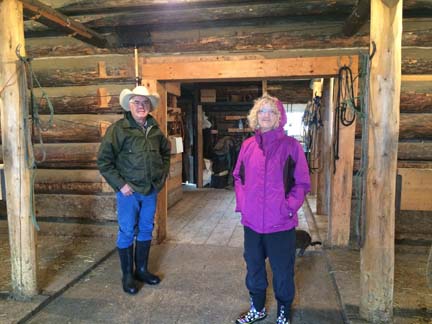
Friday was an abysmal day of unrelenting rain. I’d socialized with Jean the night before in Tom’s (now Ruth’s) very cozy tarp-o-rama, and had gotten an enthusiastic “Yes!” when I asked if I could have a tour of the ranch buildings the next day, and an offer to use the phone or internet or whatever I needed. Ruth very nicely drove me up, and she and Rick toured me around the ranch – the log barn at the Ya Ha Tinda is a National Historic Site.

ya ha barn

The historic barn, on a very rainy day.

ya ha rick and ruth

Rick and Ruth at the barn.

ya ha warden cabin

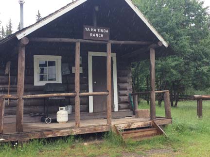
The old Warden’s cabin, still in use for ranch guests.

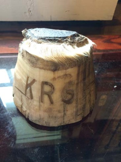
ya ha hoof brand

Hoof brand used to sort horses by year of birth and Park – system is still in use today.

In his pre-ranch manager life, Rick had been a bronc rider and a rancher and an outfitter in Banff, and he is a great person to talk to about history and horses and riding. Anyway, there was some coffee and some chatting, and I met up with Rick and Jean again on my ride to the Outpost the next day, and I ended up being invited over for dinner, which they were sharing with a big crowd of relatives from Edmonton and the Netherlands. The rellies are beer pong experts, and, with Ruth as my partner, I had my initiation into a game I somehow (embarrassingly) missed out on learning back in high school and university. I’m no good at beer pong at all, compared to those Edmonton and European beer pong sharks.

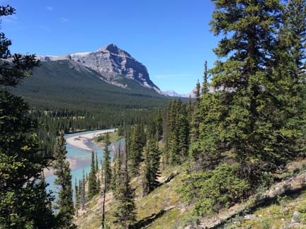
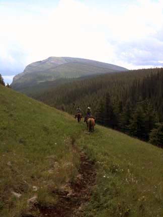
The ride earlier that day to The Outpost at Warden Rock, a place first mentioned to me by Lyle back at Nipika, was a gorgeous one. Pai and I set off on our own again on a bright and sunny Saturday morning, taking the meandering trail that follows the Red Deer River for about 13 km until it reaches the boundary of Banff National Park.

ya ha trail to warden 2

On the way to Warden Rock.

ya ha trail to warden

Warden Rock and the Red Deer River.

ya ha skull

Someone picked a terribly scenic place to die.

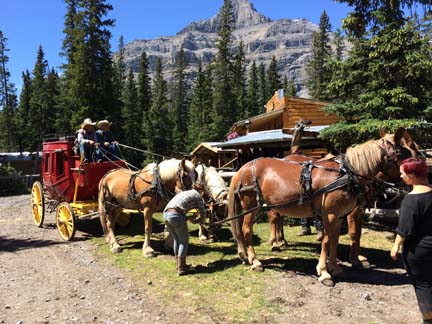
The Outpost sits in a little no-man’s land between the ranch and the park. Tim Barton takes people in by stagecoach across the Ya Ha Tinda, and the guests stay in sweet little cabins on the river, surrounded by mountains. From there, they can ride into the Park for day or pack trips. I had a cup of coffee on the porch with Julie, Tom’s wife, and Jean, where the (questionable) wisdom of the Parks decision to re-introduce bison to Banff National Park was discussed.

ya ha stagecoach

Tim Barton and Rick on the stagecoach.

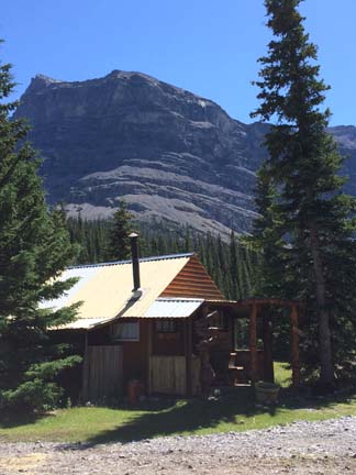
ya ha outpost

One of the cabins at The Outpost.

By now, I’d decided to knock Hummingbird/Ram Falls off my itinerary. There was tons more riding to do right where I was, besides which, I’d been informed that there was an ATV rally happening at Ram Falls that weekend, news that sealed the deal.

Sunday was another fine day, and we rode up to Eagle Lake again, and beyond it to James Falls.

ya ha pai at james falls

Pai at James Falls.

From there, we rode back in a loop that may or may not have been the Poplar Ridge Trail. It was on a ridge, but there were no poplars, so I think I missed my turn. No matter. I couldn’t complain about the scenery.

ya ha from poplar ridge

View across the valley from Poplar Ridge. Or wherever we were.

By now, I had new camp neighbours. In Dan’s place were Laurie and Tom, from Red Deer. Laurie had ridden at the Ya Ha Tinda many times in the past, but that had been a decade ago, and she was no longer sure of the trails. Behind me were Don and his wife (Shirley? I am abysmal at remembering names) from Ponoka, who rode Tennessee Walkers and who knew the place well; they were joined by some friends who were heading out on a 12-day pack trip with their own Tennessee Walkers.

I’d intended to leave on Monday, but if enough other riders tell you what a great ride it is to Hidden Falls, and you get the opportunity to go, well… I stayed another day. Laura and Tom and I made a date with some gals staying at Eagle Creek, Brenda and Zip, to head to the Falls; after hanging about for a long time after the appointed hour, we decided to go it on our own, and so off we went, braving the river crossing on our own – no small thing, since the river was running high and fast after the rain, and came well above the horses’ bellies.

We met up with Brenda and Zip at the falls, where they turned up a half hour or so behind us.

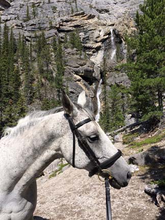
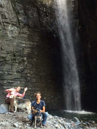
ya ha spy at hidden

At hidden falls, with Zip and Nibble too.

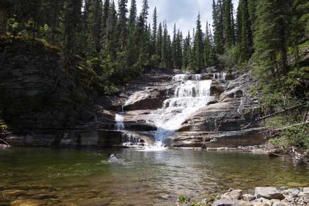
The Hidden Falls is the coolest waterfall I’ve ever seen. Photos don’t do it justice. The water spills from a sort of funnel and drops into a cavern whose walls lean and almost meet overhead.

Brenda and Zip and Tom and Laura made plans to ride the Wolf Creek loop the next day. Once again my resolve to head off wavered, and I decided to see how I felt in the morning.

The campfire that night at Ruth’s, over at Tom’s tent, was a treat. Tom’s musician friend Tracey Millar, who has a knock-you-down-flat beautiful voice, was visiting, and had brought her guitar, and so she played and sang. There was a good crowd gathered to hear her sing – Rick and Jean came down from the ranch, and brought along various wardens and other Park staff who were at the ranch on various missions – like Jim from Jasper, there to retrieve horses evacuated during the Jasper Park forest fire, and Derek and Jamie from Yoho/Banff/Kootenay, there on a 3-day horsemanship course.

And when I went to bed, I still wasn’t sure whether I’d be pulling up stakes the next day, or staying to ride.

As I was lying in bed the following morning, staring at the ceiling of my “living quarters”, I decided that it was definitely time to go. I’d get up early, pack, and get out of Dodge. And then I stepped outside. At six a.m., the sky was a cloudless deep aquamarine blue. It was not a driving day. It was a riding day.

So I joined Zip, Brenda, Tom and Laurie on the Wolf Creek loop. Zip is a great horsewoman, knows the trails minutely, and has a gentle way of dealing with people. She guides whoever wants to go on a tour with her, but won’t take a fee. “It’s a ministry,” she said. “Showing people God’s creation.” She led us on a ride that turned out to be one of the loveliest rides of my stay – there were meadows, mossy woods, hill climbs and descents, waterfalls, rock canyons, cliffs, trails clinging to hillsides, river crossing, views across valleys…

ya ha wolf creek loop

Zip and Brenda on the Wolf Creek loop, crossing the back side of Labyrinth Mountain.

Our lunch was spent by the side of a pool at the bottom of a stair-step waterfall. The day was warm enough that I had a quick swim (“quick” being the nickname for “lightning-fast”, just like “refreshing” is the pet name for “turn-your-lips-blue” – the water was seriously as cold as a bucket of ice cubes.

ya ha falls and spy on wolf creek loop

Our lunch stop – Spy having a swim in the pool.       Photo: Tom Schultz

By his third river crossing, Spy learned to start his swim upstream, so that the strong current wouldn’t land him a hundred metres downstream from where we exited the river. Smart doggie.

ya ha river crossing

Our final, easy crossing – not as deep as the others. My boots almost stayed dry on this one.

The Wolf Creek loop – which my friend Ann from Calgary had enthusiastically recommended as a must-do, and the one I almost missed – ended up being probably my favourite ride in a week of fantastic rides.

Wednesday morning dawned with an earth-shaking thunderstorm, and lightning bolts that lit up the mountains. After coffee with Tom and Laurie, I said goodbye to Ruth, and to Rick, who was doing his morning drive-through of the camp. I hope to see Rick and Jean and Ruth in Nanaimo someday down the road, and re-pay the hospitality and generosity they showed me.

I think they’re wrong about the translation, though. I’m pretty sure Ya Ha Tinda means “heaven on earth”.

ya ha rainbow

The best pot of gold you could ever hope to find is in the hills and meadows of Ya Ha Tinda.

Trail and camp notes for horsey folk:

There are two campsites at Ya Ha Tinda, both maintained by Friends of the Eastern Slopes. The Bighorn campsite is inside the ranch perimeter, the Eagle Creek campsite, which you come to first, is just outside the perimeter, which means that ATVs may occasionally appear there, though their access to trails is limited (Ya Ha Tinda does not allow motorized vehicles on the property). The Eagle Creek site is more sheltered and treed; the Bighorn site is treed but much more open, with views of the mountains.

Both campsites are along the Red Deer River, and camping is free, although it’s well worth supporting the Friends of the Eastern Slopes by buying a $30 membership. There is no potable water; horses can be watered at the river or, at Bighorn, at Bighorn Creek as well. There are pit toilets (bring your own TP).

The manure pile (bring your own fork and wheelbarrow) is at the entry gate, 700m from where I was camped. Most people drove their manure down to the pile in their pick-up trucks. If you’re pushing a barrow, it’s a bit of a slog.

Camping is fairly free-form, with people just pulling in as they please. There are tie stalls at some sites (4 stalls per structure – bring your own tarp for shade/rain shelter), skookum high-line posts at others, and other sites have no real horse confinement, but you can tie to your trailer. High-lining to trees is not allowed, nor are electric corrals, and grazing is prohibited (so no tethering or hobbling). Limited panels are allowed in a very area on the south-east side of Bighorn. Some sites have picnic tables and fire pits, some don’t.

Most (but not all) of the trailheads are at the Bighorn campsite, but from Eagle Creek, it’s an easy ride across a meadow alongside the Red Deer River (it’s maybe 3 km, which takes about 20 minutes or so if you walk it, or, if you’re Pai and you have a ground-eating trot, about 10 minutes if you trot and/or canter it).

One of the many great things about the trails at the Ya Ha Tinda is that you can always ride with a destination – a lake, a waterfall, a viewpoint, The Outpost… You can stay on the valley bottom, or you can ride up the mountains. You can ride for a couple of hours and make a nice loop, or ride all day. You could ride to The Outpost, and stay, and ride into Banff from there. You can cross the river, or not.

The terrain is varied – winding single track through trees, flat meadows, hill climbs, creek crossings – but the footing is generally very good. There are a few steep bits that would get a little slick in the rain, and some rocky areas here and there, but nothing I rode was in any way alarming.

The map (available from Tom (or Ruth)) is basic but accurate; there are also trails that don’t appear on the map. Major intersections tend to be marked by a signboard with a helpful “you are here” marker, and other trail directions are marked on moose antlers. There are enough landmarks in sight that you pretty much always have an idea of which direction you’re headed.

The operating buildings of the ranch are about 4 km from the Bighorn campsite. You can ride there, tie up, and take a tour.

ya ha bighorn camp

The Bighorn campsite on a rainy day.

2015: Interlude – Sask Landing, Dinosaur Park, and Calgary – July 10-14

After the Wood Mountain Trail Ride, there is no way anything else could compare. Any ride that followed was pretty much destined to be an anti-climax. When I was debating leaving Grasslands on Friday vs staying in the neighbourhood for the Wood Mountain Rodeo, Glen told me that wherever I ended up, I’d be wishing I was at Wood Mountain. Doug told me, “Well, you’ve got to stay somewhere. Might as well be here.”

But off I went. I sort of understand the phenomenon of having itchy feet, of wanting to move on despite having found friends and community in a particular place. It was time to move on.

So I drove to Saskatchewan Landing, a Provincial Park just north of Swift Current, that had been visited by and recommend by quite a few riders I’d chatted to at Cypress and at Grsslands.

I passed through Speedy Creek on my way, and somehow I managed to completely and utterly fail at accomplishing my single major goal: Buy Good Beer. I forgot to buy beer. I FORGOT TO BUY BEER. I . forgot. to. buy. beer.

WTF? Seriously. WTF? I texted this lapse to Mr Andrews once I discovered the error of my ways, and he texted back, “You need a giant capital L on your forehead.” Yes, yes indeed I do. I am going to blame the fact that it was 38 degrees C on the walk from the mall to the rig with groceries, and that on that walk, the heat messed with my mission of finding a liquor store.

Saskatchewan Landing is nicely set up for horses. It’s a park with something close to one bazillion regular prople campsites, but it also has an equestrian area on the east side of the river, with 10 sites. It’s shady and some of the sites have a view of the river and it’s really quite lovely.

My crankiness at leaving my cowboy family made me less receptive than usual to making friends with neighbours (“Why are they so LOUD? Why do they have to smoke? Why are there CHILDREN rustling around in the bushes making my dog crazy?”), but eventually, I came right, and socialized, and discovered that they were a group of people from the Sask Valley Riding Club, which holds group rides every couple of weeks throughout the summer.

Saskatchewan Landing is a long, narrow park bordering the South Saskatchewan River (which is Lake Diefenbaker in that area). Once you get into the hills, you kind of forget that there’s farmland a stone’s throw away, and a highway equally close.

The pleated, razorback hills with lines of slumping are pretty much exactly like the hills on the North Island of New Zealand.

Landing pleated hills over lake

Overlooking Lake Diefenbaker.

Landing pleated hills

View from our ride.

We just did one ride, the day after we arrived. I made it my mission that afternoon to fix my beer problem, and after driving 15-20 minutes to the next town and visiting two purveyors of the demon liquor, and coming up bust, I found what my heart desired at the camp convenience store, Papa Joe’s: a Swift Current micro brew IPA, that I’d already sampled when I was in Taber.

After our ride at Sask Landing, as I was moseying about camp, a fella approached me and asked me about the local riding. We ended up chatting for quite a while. I needed a plan for where to stay next, on my way to Ya Ha Tinda northwest of Calgary, and he spent some serious time drawing me a map of where he used to ride in Dinosaur Provincial Park in Alberta.

Since we were now buds, and he seemed pretty outdoorsy, I asked him, “Do you know anything about fishing?” Because, fairly typically of me, I’d had grand ideas of catching fish on this trip and cooking them up for dinner. Excellent, right? Except I don’t actually know how to tie a hook to the line, or what lure is best for what fish, or, really, when it comes down to it, anything whatsoever about fishing. John The Outdoor Guy sorted me out, and off I went to fish.

I fished for about ten minutes. I was actually out there for an hour, if you include walking to the spot, but only ten minutes was spent fishing. A bit of time was spent trying to cast and realizing I had no frickin’ idea what I was doing. Then there was some time spent phoning Mr Andrews and asking him how a person actually might accomplish This Thing Called Fishing. And then, for no good reason whatsoever, my line snarled up around the rod apparatus whose name I don’t even know (reel?), and I spent at least 20 minutes swearing a blue streak at my fishing rod.

Landing sunset

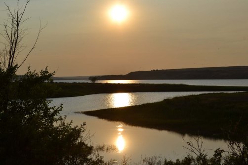
An idyllic place to fish, if you can’t hear some chick cussing out her fishing rod.

I’d spotted my other camp neighbours fishing as well, and so the next morning, when I was packing up to go, I hailed them and admired their dog and the craftily asked if they might be smart enough to fix my stupid rod. Cole (I think? Cole? Maybe?) is very good at fixing things, just like Mr Wayde Andrews, and he sorted out my rod. Phew. Back in business.

I left the Landing on Sunday, heading for Dinosaur Provincial Park. John had given me a heads-up that the free rec site (Steveville) he was recommending was likely to have no one else there (he’d never had company when he camped there), and that I needed to be comfortable camping alone. I am, but I did tell Mr Andrews where I was going to be, and that it was remote, with no cell service, and that he should hear from me within 48 hours.

As it turned out, Steveville was just about full when I got there, and full by the end of the evening. In a totally random moment of serendipity, the last people to set up camp ended up being a colleague of mine and his squeeze, en route from Spruce Meadows to the Pan Am Games in Toronto. I think it is hilarious that the two of us should meet up in a tiny backwoods campsite in Alberta.

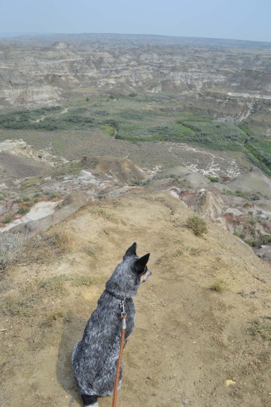
Riding in Dinosaur ended up being a bust. It had been years since John had lived and ridden here, and things had changed – his marked route had gates with chains and locks. Still, Spy and I visited the official area of the park, as well as the area around our rec site, and the views were spectacular.

Dino view with Spy Dino hoodoo thingy

When I’d been chatting up folks around the campfire in Sask Landing, and sussing out places to camp on my way towards Ya Ha Tinda, one fella told me that a place I could stay near Calgary would be Irvine’s, a tack store. If you shop in their store, he said, they’ll let you camp for free. I phoned up to confirm that this was the case, and yes, yes it is. So from Dinosaur, I drove through Drumheller to Crossfield, and Irvine’s.

It was pissing down rain when we pulled up – so really, what better to do than shop?

Irvine’s is a western store, so the dressage whip that was on my list (Spy ate mine) was a no go. I did find me some hobbles, though, and some gloves I like (Noble Outfitters – good stuff!), and a few other odds and ends.

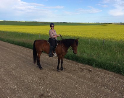
Back in 2012, I camped at and rode out from Sandy McNab campsite in Sheep River, Kananskis, where I met Ann, Vicki, and Dani. We’ve kept in touch through Facebook, and Ann has kept tabs on my whereabouts on this trip. Through a lovely twist of fate, her barn (a 50 minute drive from her house) is a 4-minute drive from Irvine’s. So we met up, and the weather had cleared, and we had a purely gorgeous evening ride through fields of canola and wheat and barley. We saw a moose! I think of moose as Northern Ontario swampy creatues. Nope. They also live in coolees in Alberta, and have naps in canola fields.

Crossfield Ann on Sage

Ann on Sage.

Crossfield moose

Moose in a canola field!

From Crossfield, we headed north and west, to Sundre, and on to Ya Ha Tinda…

Camp and trail notes for horsey folk:

Saskatchewan Landing

Sask Landing has 10 sites, and 10 corrals. The corrals are big enough for 2 horses, so I’m guessing that if you arrive with two, they should go together, but in practice, it’s a free-for-all. There’s also a big grazing field – if you wanted to set up an e-corral there, no one would care. You could probably also set one up in the “stock trailer drop-off” area. I don’t think anyone gives a damn.

Landing pai grazing

The grazing paddock.

There’s water for horses, none for people. There are pit toilets, manure disposal (wheelbarrow, forks provided), garbage. Firewood is free.

Cost $18/night plus park user fee of $7/day (which is supposed to be charged at Cypress as well, but nobody at Cypress gives a flying).

The campsites are treed and reasonably private, though you are pretty close to your neighbour. You can reserve a site should you so desire. Sites 6 thru 10 have a direct view of the lake. The others face the horse pens. I was in #2, which gave me a view of the lake across a couple of other sites, was in view of my horse, and was close to garbage and toilets.

Horse paddocks are shaded.

There are some marked (mown) trails (I didn’t find them), but I just rode out on obviously ridden but unmarked horse trails. (A rider I met at Grasslands told me he gets turned around in the draws there, but I can’t see how that would be possible – it’s a really narrow park.) The draws are steep, and there are some fairly precarious trails. There are, apparently, some bad boggy areas, but I found none – then again, it’s been a crazy-dry summer. I rode north and east from the equestrian campsite, and then south, and then northwest back home, on horse/cattle/game trails.

If you unhitch and go across to the regular campsite, you’ll find Papa Joe’s, a laundromat, the golf club restaurant…

  1. Steveville Rec Site

Steveville is not set up for horses, but it works. I set up an e-corral for Pai. There are maybe 9 or 10 sites (it’s pretty random), some with picnic tables. There is no water for people or horses – huff it down to the Red Deer River. There are pit toilets, garbage, and a very rustic (read, scruffy) cooking shelter.

You can’t access Dinosaur. You could ride along the road that takes off to the right as you head north from camp, but it’s road riding – the road does have nice views of badlands (I walked Spy there).

  1. Irvine’s

Free. No one seems to care what or if you spend in the store. You just pull up to the pipe corrals, and Bob’s your uncle. I used tape (not electrified) to set Pai up with a grazing area in an alley next to their outdoor arena. There is no water, and I couldn’t see any toilets. (Yeah. No toilets. Hello horse trailer.) But whatevs. It was free.

Save